
c.1852 Panoramic Plan of the Principal Rivers and Lakes
89 in stock
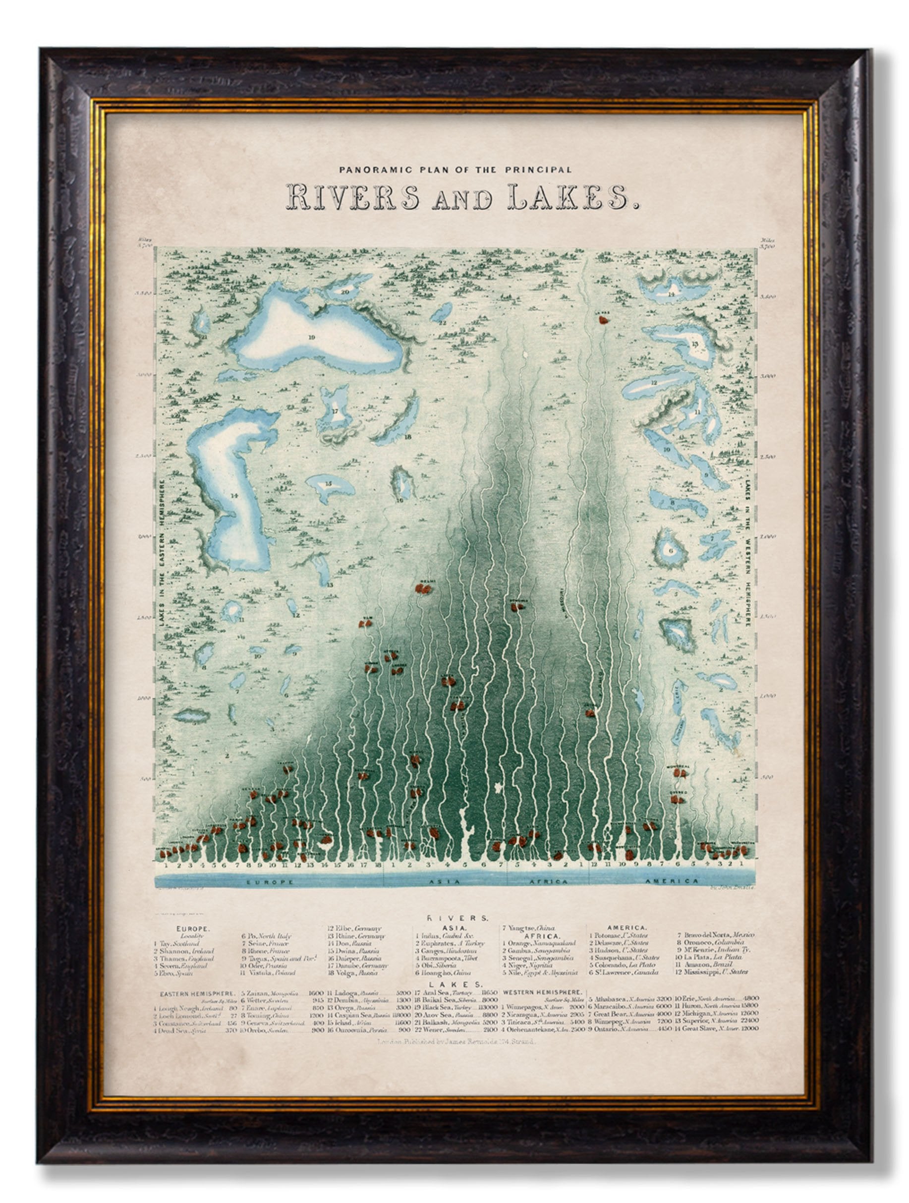
This delightfully detailed panoramic plan shows the lengths of the major rivers of the world, divided into continents and with the length marked along the side. Below, the lakes and rivers are listed by hemisphere and continent respectively. This spectacular illustration references an original print from the mid-19th century, which would have been produced in black and white and then coloured brightly by hand. We’ve digitally remastered it here in our Lancashire studio to restore it to its former glory.
Printed and framed using archival methods for exceptional quality and durability, this chart of rivers and lakes comes mounted in a sustainable wood frame ready for you to hang. As with all our prints, each and every element is hand cut, printed and assembled in Britain to create pictures of distinction with minimal carbon footprint.